Your search returned 354 results in the Category: social studies - countries (including life in).
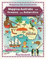
MAPPING AUSTRALIA & OCEANIA & ANTARCTICA
By: paul rockett | Published: August 2016
Detailed photos and full-color maps help take readers on a fascinating visual journey through the diverse and intriguing continents of Australia and... [Read More]
Detailed photos and full-color maps help take readers on a fascinating visual journey through the diverse and intriguing continents of Australia and Oceania, and Antarctica! This book's appealing format highlights the facts about the human and physical geography of these continents. Readers will put their analytical skills to use to interpret different types of maps as sources of information, from physical maps that show the region's landmarks to political maps that teach about the region's countries to interesting cultural and thematic maps.
- ISBN
9780778726142 - Binding
Hardcover - Category
Social Studies - Countries (including Life In)
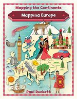
MAPPING EUROPE
By: paul rockett | Published: August 2016
Detailed photos and full-color maps help take readers on a fascinating visual journey through Europe! This book's appealing format highlights... [Read More]
Detailed photos and full-color maps help take readers on a fascinating visual journey through Europe! This book's appealing format highlights the facts about the human and physical geography of the continent. Readers will put their analytical skills to use to interpret different types of maps as sources of information, from physical maps that show the region's landmarks to political maps that teach about the region's countries to interesting cultural and thematic maps.
- ISBN
9780778726159 - Binding
Hardcover - Category
Social Studies - Countries (including Life In)
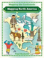
MAPPING NORTH AMERICA
By: paul rockett | Published: August 2016
Detailed photos and full-color maps help take readers on a fascinating visual journey through North America! This book's appealing format... [Read More]
Detailed photos and full-color maps help take readers on a fascinating visual journey through North America! This book's appealing format highlights the facts about the human and physical geography of the continent. Readers will put their analytical skills to use to interpret different types of maps as sources of information, from physical maps that show the region's landmarks to political maps that teach about the region's countries to interesting cultural and thematic maps.
- ISBN
9780778726166 - Binding
Hardcover - Category
Social Studies - Countries (including Life In)
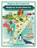
MAPPING SOUTH AMERICA
By: paul rockett | Published: August 2016
Detailed photos and full-color maps help take readers on a fascinating visual journey through South America! This book's appealing format... [Read More]
Detailed photos and full-color maps help take readers on a fascinating visual journey through South America! This book's appealing format highlights the facts about the human and physical geography of the continent. Readers will put their analytical skills to use to interpret different types of maps as sources of information, from physical maps that show the region's landmarks to political maps that teach about the region's countries to interesting cultural and thematic maps.
- ISBN
9780778726173 - Binding
Hardcover - Category
Social Studies - Countries (including Life In)
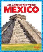
MEXICO - ALL AROUND THE WORLD
By: amy rechner | Published: January 2019
In this book, readers will learn about the unique and defining features of Mexico. Vibrant, full-color photos and carefully leveled text will engage... [Read More]
In this book, readers will learn about the unique and defining features of Mexico. Vibrant, full-color photos and carefully leveled text will engage young readers as they learn more about the key details of the country including geography, climate, culture, and resources. Compelling questions encourage further inquiry. Review: Information-packed, volumes cover the history, government, nature, geography, climate, resources, people, and recreational activities of each titular nation. Excellent color photos, many capturing the diversity of local people, convey the country's vibrancy, as does each title's upbeat tone. "Did You Know?" and "What Do You Think?" sidebars add information and/or pose questions; titles sometimes also use graphics to convey data. Highlights of each book include a "before-and-after-reading" guide for adults that offers strategies to develop students' nonfiction reading skills. Iraq omits all mention of political turmoil; Brazil suggests the nation's now-impeached president remains in office, which dates the volume. VERDICT Notable for its breadth, this series would make a fine introduction to world nations. --School Library Journal (10/26/2018) "About this title" may belong to another edition of this title.
- ISBN
9781624969195 - Binding
Hardcover - Category
Social Studies - Countries (including Life In)

MEXICO - COUNTRY PROFILES
By: marty gitlin | Published: January 2018
Mexico is a cactus capital. Giant cardon, the worlds tallest cactuses, grow in the Sonoran Desert. They reach heights up to 63 feet! And Mexicans... [Read More]
Mexico is a cactus capital. Giant cardon, the worlds tallest cactuses, grow in the Sonoran Desert. They reach heights up to 63 feet! And Mexicans also eat the stems of prickly pear cactuses like vegetables! This country profile takes kids south of the border to explore Mexico. "About this title" may belong to another edition of this title.
- ISBN
9781626176850 - Binding
Hardcover - Category
Social Studies - Countries (including Life In)

MEXIQUE - A REFUGEE STORY FROM THE SPANI
By: maria ferrada | Published: October 2020
On May 27, 1937, over four hundred children sailed for Morelia, Mexico, fleeing the violence of the Spanish Civil War. Home was no longer safe, and... [Read More]
On May 27, 1937, over four hundred children sailed for Morelia, Mexico, fleeing the violence of the Spanish Civil War. Home was no longer safe, and Mexico was welcoming refugees by the thousands. Each child packed a suitcase and boarded the Mexique, expecting to return home in a few months. This was just a short trip, an extra-long summer vacation, they thought. But the war did not end in a few months, and the children stayed, waiting and wondering, in Mexico. When the war finally ended, a dictator--the Fascist Francisco Franco--ruled Spain. Home was even more dangerous than before. This moving book invites readers onto the Mexique with the "children of Morelia," many of whom never returned to Spain during Franco's almost forty-year regime. Poignant and poetically told, Mexique opens important conversations about hope, resilience, and the lives of displaced people in the past and today.
- ISBN
9780802855459 - Binding
Hardcover - Category
Social Studies - Countries (including Life In)
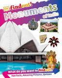
MONUMENTS OF INDIA
By: dk | Published: October 2020
Explore the monuments of India--from the earliest cave paintings and megaliths to timeless landmarks. Find out about India's fascinating history and... [Read More]
Explore the monuments of India--from the earliest cave paintings and megaliths to timeless landmarks. Find out about India's fascinating history and amazing architecture in DK findout! Monuments of India. The book will teach children about the rise and fall of significant kingdoms, and how this affected changes in architectural styles. Learn about the site of the Buddha's Enlightenment, richly decorated temples and mosques, the intricate details of the forts and palaces that flourished under the Mughals and the Rajputs, and more. The DK findout! series introduces children to a range of exciting topics in a fun, engaging way. Checked by specialist consultants and an educational expert, this is not only a source of information you can trust, but one that is age-appropriate and supports your child's schoolwork.
- ISBN
9780744021882 - Binding
Hardcover - Category
Social Studies - Countries (including Life In)
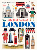
MY 1ST BOOK OF LONDON
By: ingela arrhenius | Published: September 2020
Take an eye-opening look at the wonders of London in a stylish big picture book for little travelers. From the Beefeaters at the Tower of London to... [Read More]
Take an eye-opening look at the wonders of London in a stylish big picture book for little travelers. From the Beefeaters at the Tower of London to the Changing of the Guard at Buckingham Palace, from red telephone booths to black cabs, the city of London offers many sights to see. In colorful, graphic spreads, look for fountains and full English breakfasts, museums and monuments, afternoon tea and art galleries--and discover all the things big and small, new and old, that make London one of a kind. Bountifully illustrated and beautifully designed, this gift for London lovers is the second in a series about great cities of the world.
- ISBN
9781536209914 - Binding
Hardcover - Category
Social Studies - Countries (including Life In)

MY LITTLE GOLDEN BOOK ABOUT BOSTON
By: judy katschke | Published: November 2022
Explore Boston with a fun Little Golden Book guidebook written specifically for the youngest tourists and residents. Get ready to explore Boston with... [Read More]
Explore Boston with a fun Little Golden Book guidebook written specifically for the youngest tourists and residents. Get ready to explore Boston with Beanie the Boston Terrier as your guide! This Little Golden Book highlights major attractions of this wicked awesome city, including Paul Revere's House, Fenway Park, the Greenway Carousel, and the Franklin Park Zoo. Plus, there are great activity ideas, such as riding in a swan boat, enjoying a frosty Boston frappe, and following the Freedom Trail! This book is perfect for families with young kids who are visiting Boston, as well as residents who want to discover more of their hometown. Look for Little Golden Books about these other exciting cities: - Washington D.C. - New York City - Seattle - Philadelphia - Chicago - San Francisco
- ISBN
9780593479407 - Binding
Hardcover - Category
Social Studies - Countries (including Life In)
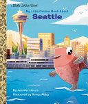
MY LITTLE GOLDEN BOOK ABOUT SEATTLE
By: jennifer liberts | Published: November 2022
Explore Seattle with a fun guidebook written specifically for the youngest tourists and residents. Get ready to explore Seattle with Sammy the Salmon... [Read More]
Explore Seattle with a fun guidebook written specifically for the youngest tourists and residents. Get ready to explore Seattle with Sammy the Salmon as your guide! This Little Golden Book highlights major attractions of the Emerald City, including Pike Place Market, the Seattle Aquarium, the Museum of Flight, and the Space Needle. Plus, there are great suggestions for things to do, such as observe sea life in tide pools and ride the monorail! This book is perfect for families with young kids who are visiting Seattle, as well as residents who want to discover more of their hometown. Look for Little Golden Books about these other exciting cities: - Washington D.C. - New York City - Boston - Philadelphia - Chicago - San Francisco
- ISBN
9780593379233 - Binding
Hardcover - Category
Social Studies - Countries (including Life In)
NATIONAL MONUMENTS OF THE USA
By: cameron walker | Published: June 2023
- ISBN
9780711265493 - Binding
Hardcover - Category
Social Studies - Countries (including Life In)
NATIONAL PARKS SCAVENGER HUNT
By: stacy tornio | Published: May 2023
- ISBN
9781643261768 - Binding
Paperback - Category
Social Studies - Countries (including Life In)
NEPAL
By: lisa owings | Published: January 2014
"Developed by literacy experts for students in grades three through seven, this book introduces young readers to the geography and culture of... [Read More]
"Developed by literacy experts for students in grades three through seven, this book introduces young readers to the geography and culture of Nepal"--
- ISBN
9781626170698 - Binding
Hardcover - Category
Social Studies - Countries (including Life In)
NGKIDS U S ATLAS 7TH EDITION
By: ng | Published: July 2023
Discover and explore the U.S.A. in the fully updated seventh edition of this award-winning atlas, created especially for kids by the world-renowned... [Read More]
Discover and explore the U.S.A. in the fully updated seventh edition of this award-winning atlas, created especially for kids by the world-renowned National Geographic cartographers. Celebrate America’s grandeur and diversity with more than 75 National Geographic maps, more than 350 color images, 50-plus attention-grabbing graphics, and more. Each state has its own detailed, easy-to-read map plus a brief essay, facts at a glance about population, state capital, statehood date, and the state flag, bird, and flower, as well as highlights unique to the state. Physical maps of each geographic region make it easy to see the mountains, rivers, lakes, deserts, and prairies that make up America’s diverse landscape. Vibrant, full-color photo essays bring each region to life. Every statistic in every fact box, every statement in every essay, and every symbol on every map has been carefully researched to ensure that the National Geographic Kids United States Atlas provides the most accurate, up-to-date information available. Count on National Geographic to bring you the very best U.S. atlas for school and family use. The perfect reference for kids to learn about all 50 states, U.S. territories, and Washington, D.C.!
- ISBN
9781426374210 - Binding
Hardcover - Category
Social Studies - Countries (including Life In)
